Why Trail Running?
Trail running combines the meditative flow of running with the adventure of hiking. It's about being in nature, challenging yourself physically and mentally, and experiencing the pure joy of movement through beautiful landscapes.
🏔️ Kettle Moraine State Forest - Southern Unit
Lapham Peak
Location: Delafield, Wisconsin
- Trails: 17+ miles of trails including the Meadow, Moraine Ridge, and Ice Age Trail segments
- Elevation: Summit at 1,233 feet, highest point in Waukesha County
- Terrain: Rolling hills, wooded trails, observation tower with panoramic views
- Highlights: Well-maintained trails, great for hill training, beautiful fall colors
- Distance from Milwaukee: ~45 minutes west
- Interactive Map: Lapham Peak Interactive Trail Map
📷 Photos
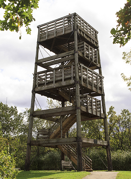
Observation Tower
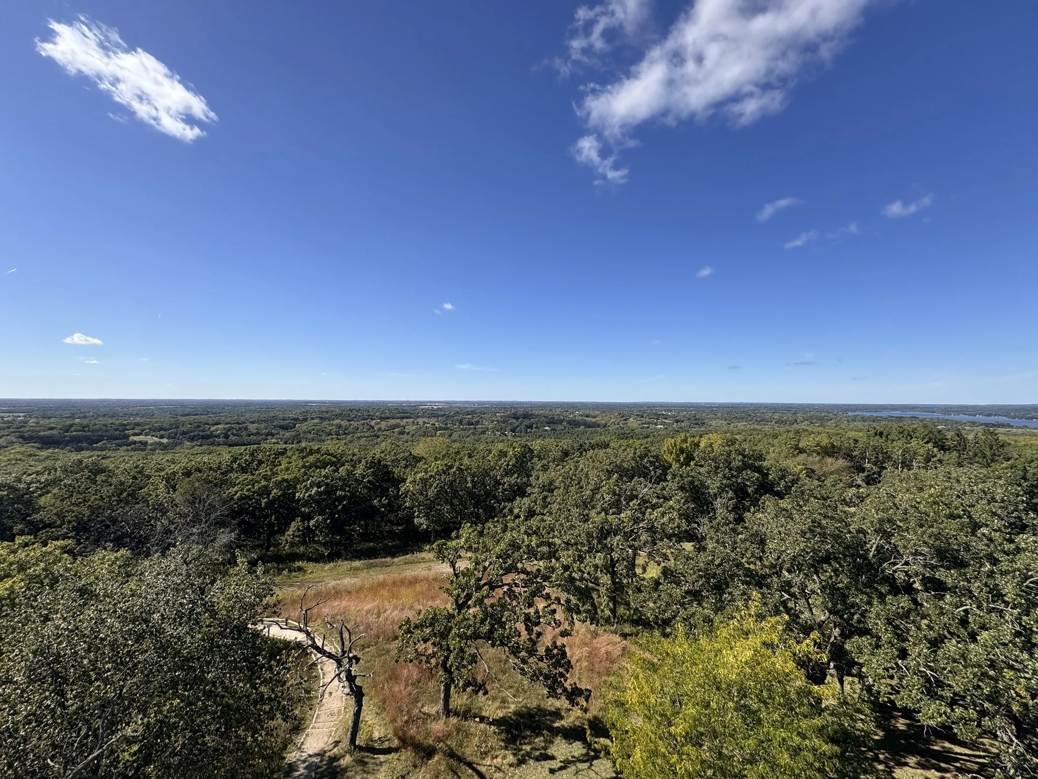
View from Tower
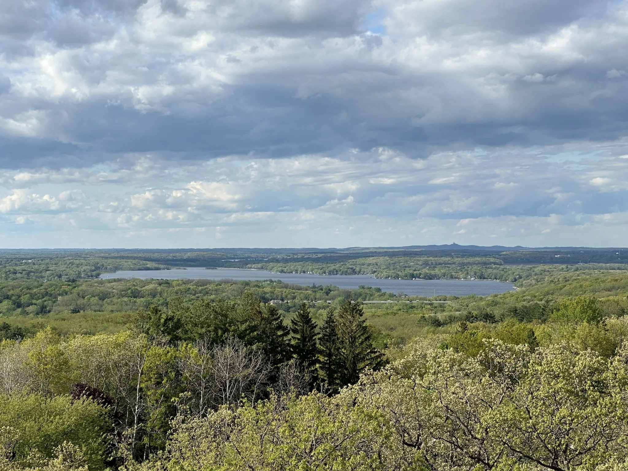
Panoramic View
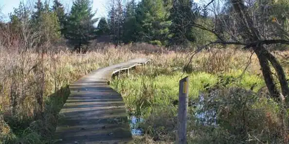
Boardwalk Trail
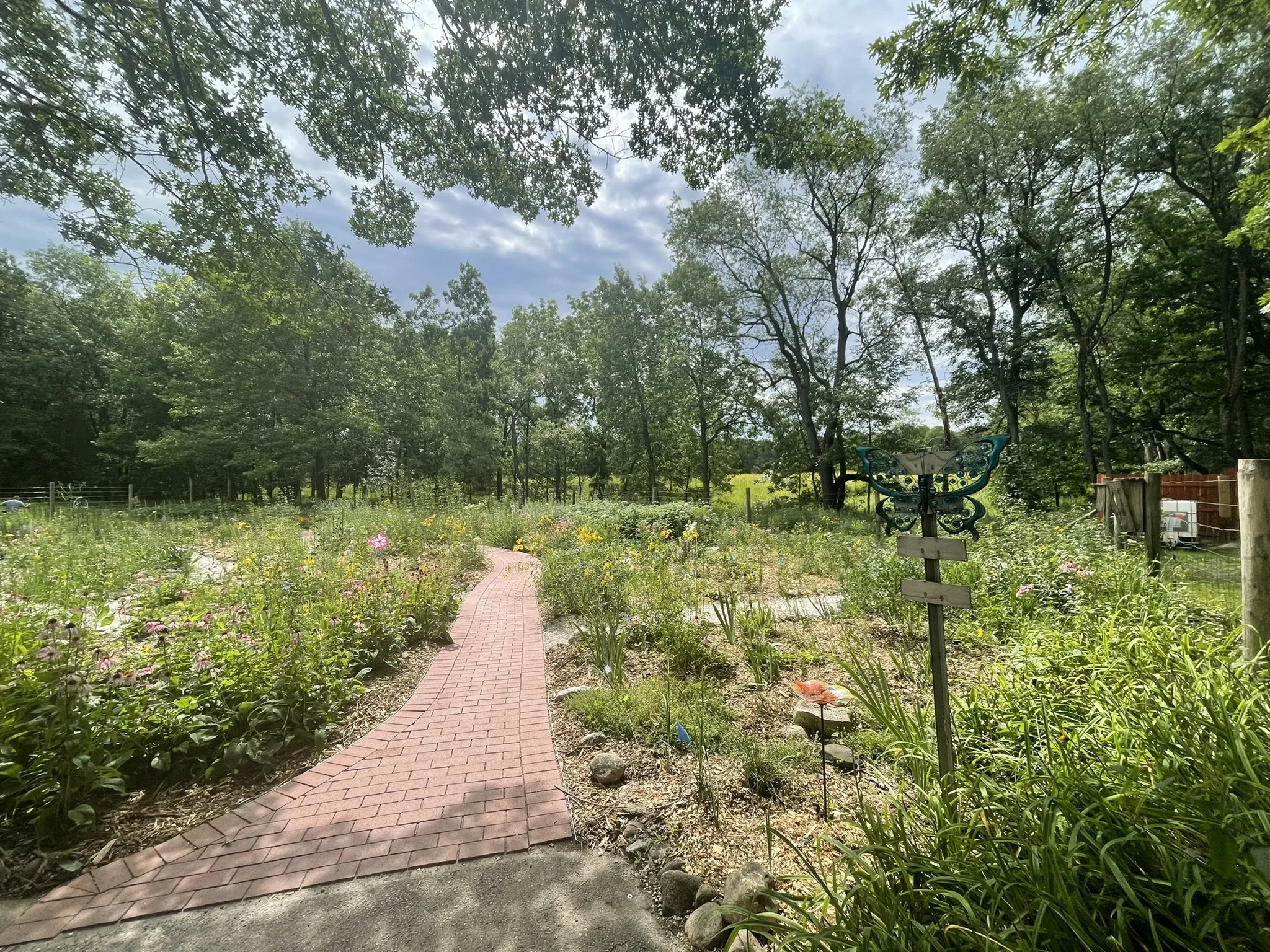
Butterfly Garden
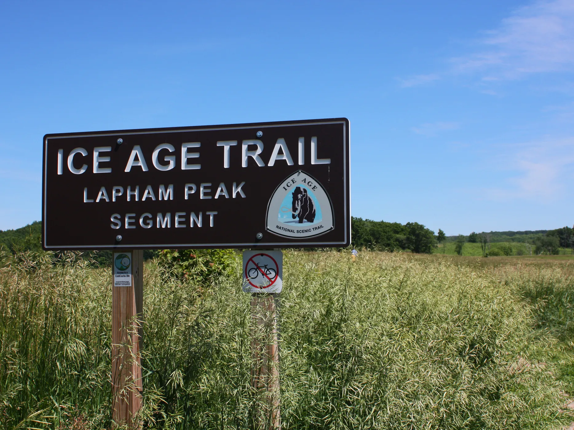
Ice Age Trail Sign
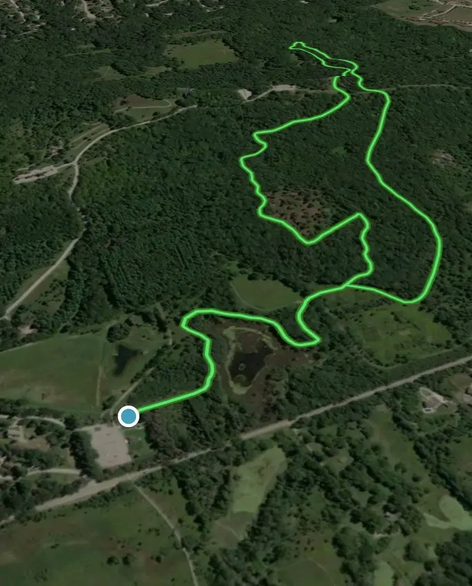
Aerial View
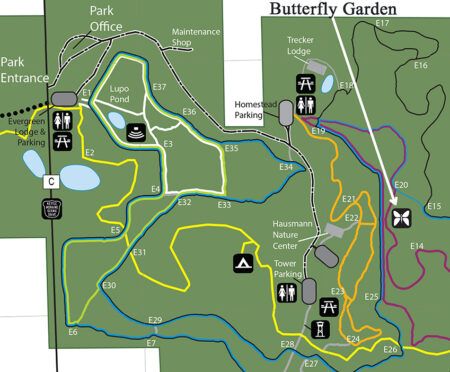
Trail Map
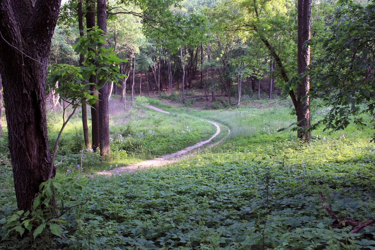
Trail View
Other Southern Unit Sections
- Scuppernong Trail System: 15+ miles of interconnected loops, one of the most popular sections of the Southern Unit with varied terrain
- Whitewater Lake: 9+ miles of trails around scenic lake, mix of forest and prairie
- Emma Carlin Trail: 5-mile loop, technical single-track through glacial terrain
- John Muir Trail: 7-mile loop, challenging hills and beautiful kettle formations
- Nordic Trail: 4+ miles, rolling terrain through oak and hickory forests
- McMiller Sports Center: Network of trails with ski area terrain
⛰️ Devil's Lake State Park
About Devil's Lake
Location: Baraboo, Wisconsin
- Trail Network: 29+ miles of hiking trails, many suitable for trail running
- Signature Trails: East and West Bluff trails with 500-foot quartzite bluffs
- Terrain: Extremely challenging—steep, rocky climbs and technical descents
- Highlights: Stunning lake views, rock formations, some of the most challenging trails in Wisconsin
- Distance from Milwaukee: ~1 hour 20 minutes northwest
- Popular Routes: Balanced Rock Trail, Tumbled Rocks Trail, CCC Trail, Steinke Basin Trail
- Note: Very technical—great for building strength and technical skills
🏔️ Kettle Moraine - Pike Lake Unit
About Pike Lake Unit
Location: Hartford, Wisconsin (Washington County)
- Trail Network: 10+ miles of trails around Pike Lake
- Terrain: Rolling wooded hills with scenic lake views
- Highlights: Powder Hill offers panoramic views; quieter than Southern and Northern units
- Distance from Milwaukee: ~45 minutes northwest
- Features: Ice Age Trail passes through, good mix of easier and moderate trails
- Amenities: Beach, camping, well-maintained trails
⛪ Holy Hill
About Holy Hill
Location: Hubertus, Wisconsin (Washington County)
- Trail Network: ~10 miles of trails on and around the hill
- Elevation: 1,350 feet at summit, one of the highest points in southeastern Wisconsin
- Terrain: Challenging climbs with significant elevation gain
- Highlights: Iconic basilica at summit, incredible views from observation towers, part of Ice Age Trail
- Distance from Milwaukee: ~35 minutes northwest
- Popular for: Hill repeats and elevation training
- Note: Parking fee; respect pilgrims visiting the shrine
🦌 Retzer Nature Center
About Retzer Nature Center
Location: Waukesha, Wisconsin
- Trail Network: 4+ miles of trails through diverse habitats
- Terrain: Gentle to moderate rolling terrain, very accessible
- Highlights: Prairie restoration, woodland trails, great for easy recovery runs
- Distance from Milwaukee: ~30 minutes west
- Features: Educational center, planetarium, well-maintained trails
- Best for: Shorter runs, beginners, or active recovery days
🌲 Havenwoods State Forest
About Havenwoods
Location: Milwaukee, Wisconsin (city limits)
- Trail Network: 6+ miles of trails
- Terrain: Flat to gently rolling, grassland and woodland
- Highlights: Only state forest within a major U.S. city; great for quick workouts
- Distance from Milwaukee: Within city limits, north side
- Features: Prairie, wetlands, and forest; good for bird watching
- Best for: Convenient urban trail running, shorter runs, after-work training
- Amenities: Environmental education center, parking
🌳 9 Mile Forest
About 9 Mile Forest
Location: Wausau, Wisconsin (Marathon County)
- Trail Network: 12+ miles of interconnected trails
- Terrain: Rolling hills through hardwood forest with pine plantations
- Surface: Natural single-track, well-maintained
- Uses: Multi-use trails for running, hiking, mountain biking (separate designated trails), and cross-country skiing in winter
- Highlights: Beautiful forest setting, great for all skill levels, popular local training spot
- Distance from Wausau: ~10 minutes northeast
- Amenities: Parking area, trail map kiosks, well-marked trails
🥾 Ice Age Trail
About the Trail
A 1,200-mile National Scenic Trail that traces the edge of the last glacial advance in Wisconsin, approximately 12,000 years ago.
Trail Characteristics:
- Total Length: ~1,200 miles when complete
- Terrain: Glacial moraines, kettles, eskers, and kames
- Runs through: Kettle Moraine State Forest (both Northern and Southern units)
- Trail Surface: Natural surface, single-track, some rocky/rooty sections
- Difficulty: Varies from easy to challenging depending on section
Notable Kettle Moraine Sections:
- Southern Unit: ~30 miles through Lapham Peak, Eagle, and Whitewater Lake areas
- Northern Unit: ~30+ miles through Dundee, Greenbush, and New Fane areas
- Scenic Highlights: Glacial formations, forest canopy, kettle lakes, prairie vistas
- Access Points: Multiple trailheads with parking throughout the forest
Resources:
- Ice Age Trail Alliance website for maps and conditions
- AllTrails and Gaia GPS for navigation
- Trail passes required for Wisconsin State Parks
🌲 Kettle Moraine State Forest - Northern Unit
Northern Unit Trail Systems
- Greenbush Trail System: 30+ miles of interconnected loops, varied terrain with significant elevation changes
- New Fane Trail: 7+ miles through forest and prairie with glacial features
- Zillmer Trail: Connects various sections, part of Ice Age Trail
- Butler Lake Area: Scenic trails around pristine lake with beach access
- Mauthe Lake Recreation Area: Trail network with lake views and camping
Northern Unit Highlights:
- More remote and less crowded than Southern Unit
- Significant elevation changes and technical terrain
- Beautiful glacial kettles and moraine formations
- Excellent for long training runs and exploring
- Distance from Milwaukee: ~1 hour north
🏁 Wisconsin Trail Races - 2026
Spring Races
- Kettle Moraine 100 (May): 100-mile, 100K, 50-mile, and 38-mile options through Southern Unit. One of the toughest ultras in the Midwest
- Ice Age Trail 50 (May): 50-mile and 50K point-to-point along the Ice Age Trail
- Zumbro 100 (April): Near Minnesota border, 100-mile, 50-mile, and 17-mile options with significant elevation
Summer & Fall Races
- Dances with Dirt Devil's Lake (June): Marathon and half-marathon at Devil's Lake State Park, challenging bluff trails
- Lapham Peak Trail Race (August): 20K and 10K on Lapham Peak trails, great for beginners and experienced runners
- White River 50 (September): 50-mile and 50K in Kettle Moraine Northern Unit
- Glacial Trail 50K (October): Point-to-point through Kettle Moraine Southern Unit
- Potawatomi Trail Runs (October): 50K, 27-mile, and 17-mile at Devil's Lake State Park
Winter Races
- Ice Age Trail 50K Winter Ultra (February): Winter ultra through snowy terrain
- Frozen Gnome (January): 10K, 20K, and 50K winter trail races at Lapham Peak
Race Organizations & Resources
- Kettles Trail Running: Hosts multiple races in Kettle Moraine
- Vacation Races: Organizes Ice Age Trail races
- UltraSignup.com: Registration and race calendar
- Wisconsin Trail Running Series: Points series across multiple races
Resources & Community
Books & Media
- "Born to Run" by Christopher McDougall
- "Relentless Forward Progress" by Bryon Powell
- "Training Essentials for Ultrarunning" by Jason Koop
- iRunFar (website & podcast)
- Trail Runner Magazine
Apps & Tools
- Strava (tracking & community)
- AllTrails (finding trails)
- Gaia GPS (navigation)
- TrainingPeaks (structured training)